Tag Archives: craters

Version 1. Launched.

The Evolution of Silence version 1—www.evolution-of-silence.net

The Hatchfund fundraiser ended in October, and thanks to all my wonderful supporters, I raised $3,827 towards my project!

Part of the funding has already covered the costs of working with web developer, Danniel Gaidula. We have completely revamped and refined the web-based archive. This is a significant programming achievement! ‘The Evolution of Silence’ requires that over 900 individual images be processed at once (to form the aerial tiling of the landscape), and as other image, video, and audio layers are revealed it can become very intense for any system. We developed a unique approach to the design and coding, and I am happy to say that is now live and working! Continue reading
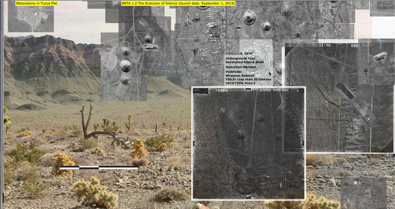
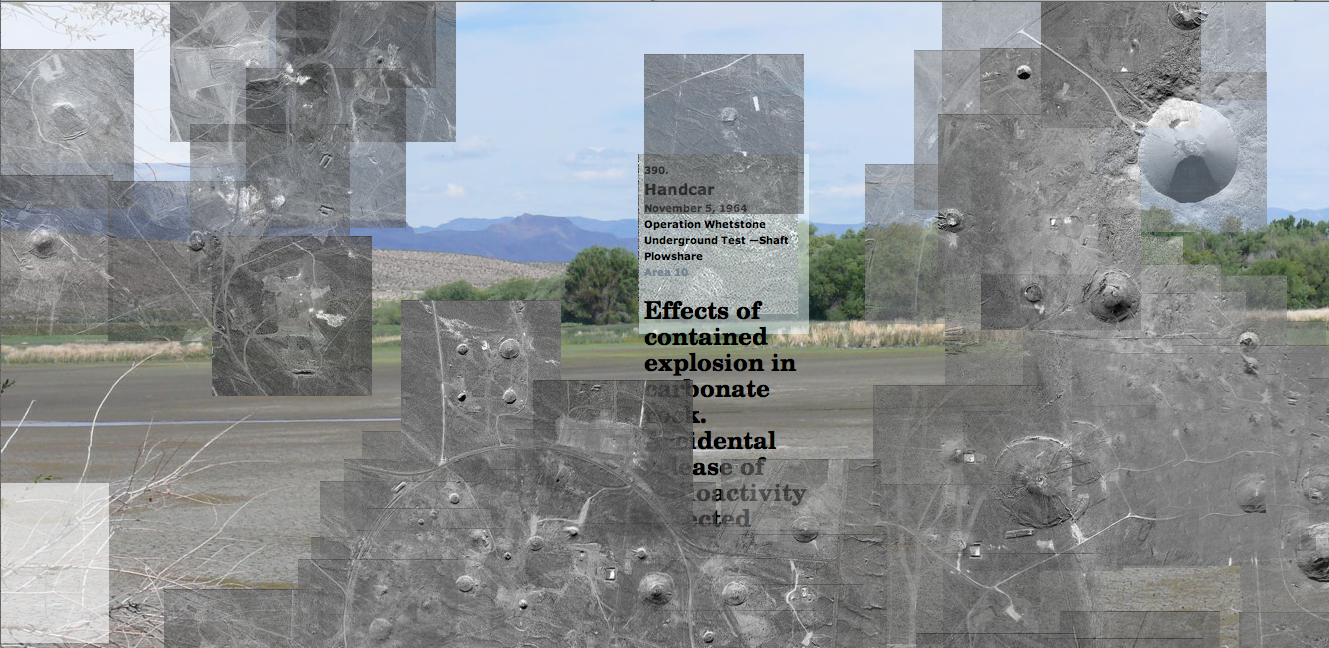
Adding USGS ‘Before’ and ‘After’ Shots.

I added 296 images to my Web-based archive last week. The ‘before’ and ‘after’ test shots (or ‘pre’ and ‘post’ shots) that I acquired via Freedom of Information Act Request from the U.S. Geological Survey and the National Nuclear Security Administration, Nevada Site Office are now included in the project.

1

Continue reading

Interacting with Pages, Experiments.

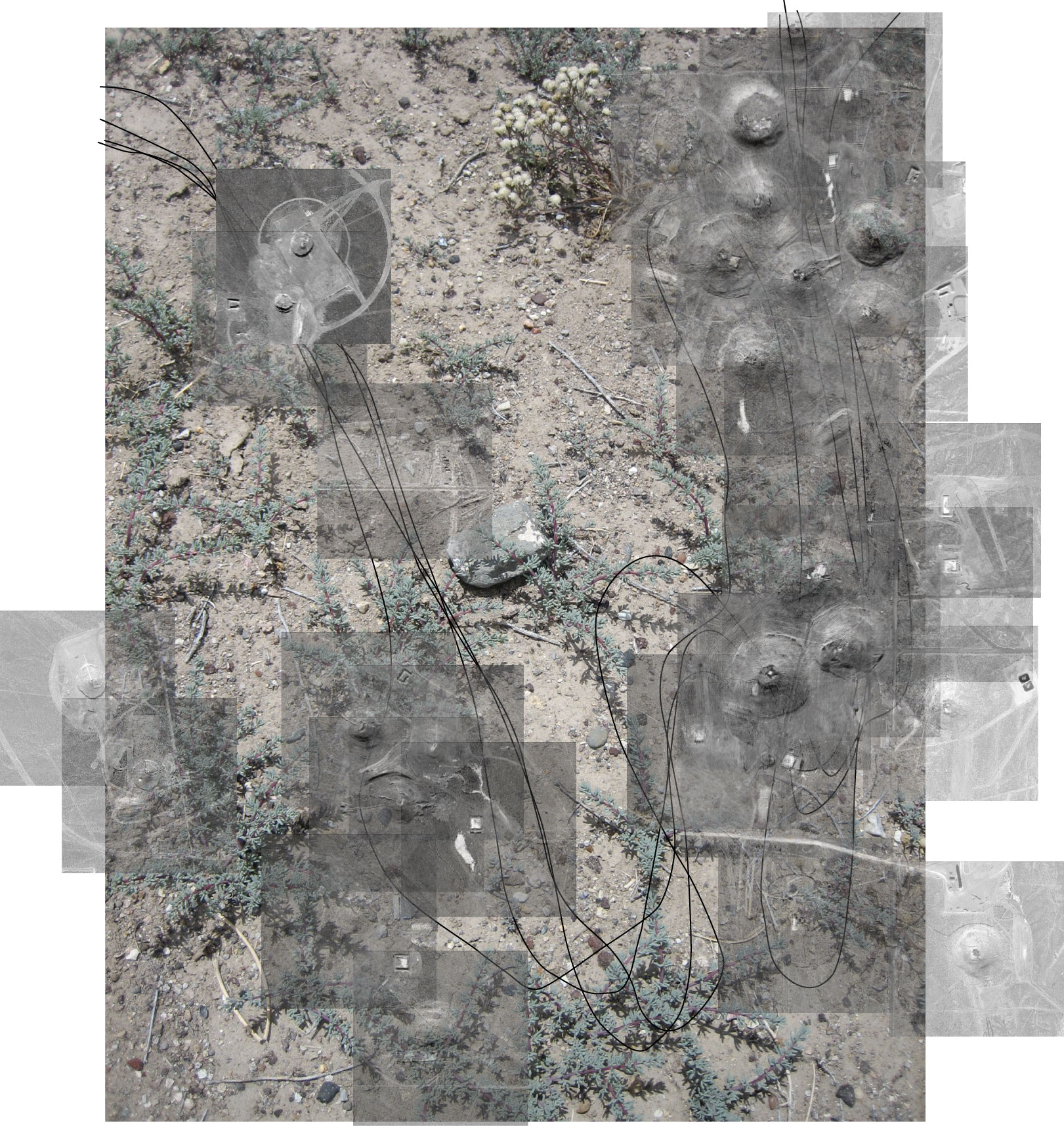
I am in the studio, finding a creative work flow, and engaging some of my material (drawings, prints, photos) in different ways. In describing these experiments to a friend, she said they sounded meditative. I love this insight. She offered thoughts on documentation, documentation of performance, and animation. After our talk, I am inspired to continue the experiments, now with greater emphasis on time structure and meaning. Currently, these are shot without much thought to duration and pacing (though there were clearly ‘seasons’ to nuclear testing, periods of intense activity and then of pause). I would like to be more sensitive to this in my project.

Interacting with Pages (First 199 nuclear detonations at Yucca Flat), Experiment 4:

Continue reading

BETA Version 1.1.

The web-based archive of ‘The Evolution of Silence’ will officially launch on September 1, 2013. I have made progress this week and am now sharing the BETA site more widely for feedback. Over the next two months, I will be incorporating more of my research material, writing, and art (solar prints, animations, and coaxial cable drawings, etc.), testing programming and design ideas on my local file, and updating the BETA versions regularly for your feedback. Continue reading

Plans for Part One.

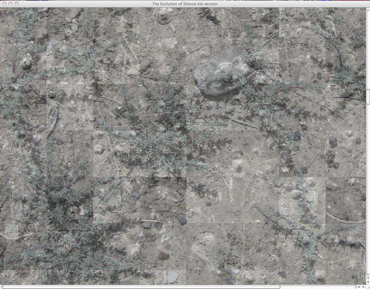
Screen Shot 2013-02-28 at 7.33.02 AM
I finished fixing the coordinates last week, and now the images tile correctly to form a view of every single detonation in Yucca Flat. It is intentional that it is still fragmented, in order to make visually clear that in those areas of the valley no nuclear detonation occurred. These gaps in information are views through the accumulated image, and lead to more and more complex layering of image, text, video. My goals with these layers are to explore the valley over time, convey dynamics and scale, present the ruins of testing, and share documentation of the impact on people’s lives and the environment. At the moment, photographs from the Desert Wildlife Range and the surrounding areas of the Nevada Test Site are visible. Continue reading

Proofing my map.

It’s especially moments like these when I wish I could afford to hire a studio assistant. After hours of mapping Yucca Flat last fall, I realized in proofing details in my code, that some of the coordinates for the map are wrong, and that the web is not translating parts of it correctly. It’s difficult to pinpoint where the mistakes are (with so many images tiled upon another), so I have no other option but to go through each detonation again. I will copy the ‘x’ and ‘y’ coordinates again for each: from my master map in Illustrator into my database in Excel (the file that drives the web map). This is a time-consuming task and, as a result, my other studio plans come to a halt. The map is one of the dominant visual features to the archive and it must be accurate. Starting today, let’s see how long this takes me.

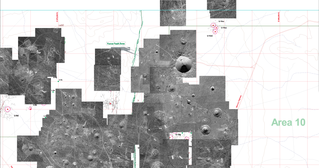
My map in Illustrator (Area 2 and 10 in view):
Screen Shot 2013-01-30 at 9.44.10 PM Continue reading

Aerial photographs acquired from the USGS, the Freedom of Information Act.

In June 2011, I discovered that the United States Geological Survey (USGS) Mercury Core Library and Data Center in Henderson, NV stores ‘pre’ and ‘post’ detonation photographs of many nuclear tests conducted at the Nevada Test Site. I immediately inquired if I could have access to the photos of Yucca Flat for my project. After encountering resistance to my inquiry, I filed a Freedom of Information Act Request with the National Nuclear Security Administration (in March 2012), and I am happy to say that it is finally successful. I received all the images in the mail recently: several dozens of black-and-white aerial shots that were scanned and burned to nine discs for me. I want to thank all the people at the USGS and at the NNSA Office of Public Affairs who worked to fulfill my request.

Here are a few examples: Continue reading

Research at the National Archives, nuclear detonations and craters.


These images represent just a fraction of the photographs housed at the Archives. Documentation of nuclear testing activity is stored in multiple collections. I poured through the Records of the Department of Energy, the Records of the Defense Nuclear Agency, and the Records of the Defense Civil Preparedness Agency. I will be returning to also consult the Records of the Atomic Energy Commission and to scan a few hundred images for use in my project. I’d like to thank researcher, Kevin Morrow, who generously made a few scans for me one day. Continue reading

A mapping of all underground detonations in Yucca Flat.

I finally finished mapping the sites of underground nuclear tests (still to map are the areas in which atmospheric testing took place). All underground nuclear explosions that took place in Yucca Flat are represented in this map. Individual images for each explosion at the exact site of their detonation are tiled together in (what became for me) a giant jigsaw puzzle, to form one aerial view of the valley.

Continue reading

Mapping every detonation in Yucca Flat.

This week I focused on my map. I am tiling the individual images of each detonation to form one view of Yucca Flat valley. Using the USGS map as a guide in identifying the craters, I determine the relative (x,y) positions for each image. I enter that information into my dataset. The web-based archive is designed to pull dynamically from that data file. The map will build itself as it loads online and allow the viewer to interact with each detonation separately.

Continue reading

Identifying images for a GeoEye Foundation Imagery Grant.

I applied for a GeoEye Foundation Imagery Grant last month. The Foundation ‘provides satellite imagery grants to support research projects at the university level and within non-governmental organizations.’ (geoeye.com). The committee has expressed interest in my research and has asked me to revise my list of images. (I had requested more than they normally award.) I am able to submit a request for a maximum of seven images. It was much harder than I thought it would be to choose which images will work best for my project and for all the ways I hope to extend it. After narrowing down the original list to about eleven, I tiled the individual images to see which would best together. I am requesting the two sets below, a total of seven images. Continue reading

Mapping for the web-based archive, the beginning.

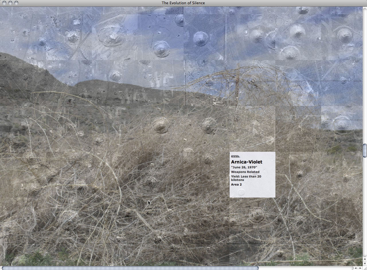
This is a screen shot sketch of the web-based map in which the detonations are organized initially by time (grid view) layered onto a photograph of the desert ground surface. It presents the sites as fragments of a landscape.


I am working to create an alternate view which will present a relational view of the detonation sites. Below is a sketch from my storyboard.

Continue reading

An Introduction to The Evolution of Silence.

An exploration of memory and destruction, ‘The Evolution of Silence’ is a multi-dimensional project that encompasses drawing, interactive design, mapping, printmaking, and installation. It is a creative investigation into the dramatic transformation of the Yucca Flat valley of the Nevada Test Site (Nevada National Security Site)—the site of experimental, post-World War II nuclear detonations.

I am creating a web-based archive, installation, and publication that present an exploration of a restricted landscape, and a visual mapping and interpretation of its destruction. ‘The Evolution of Silence’ allows one to bypass government boundaries and control of the area, making it possible for any individual to experience a cold war’s aftermath and silence. Continue reading