I am very pleased to announce that the GeoEye Foundation has approved my grant application. In August I submitted a proposal and request for several high resolution images of Yucca Flat for use in my project, not just for the archive online but for the ways I plan to extend the project as an exhibition.
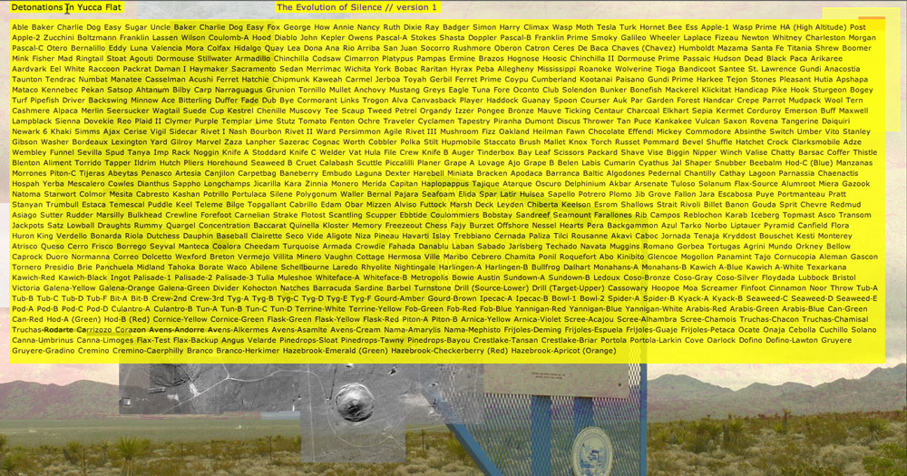
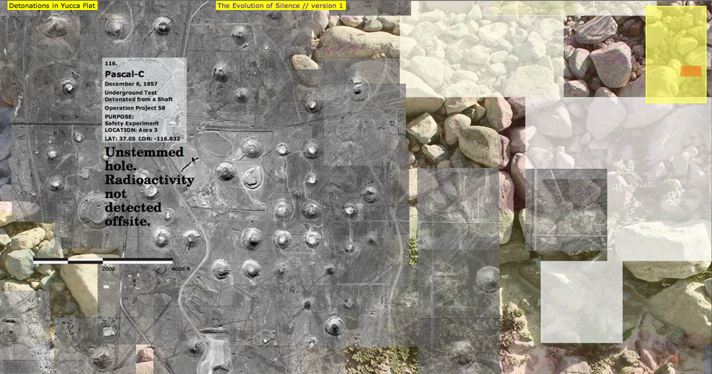
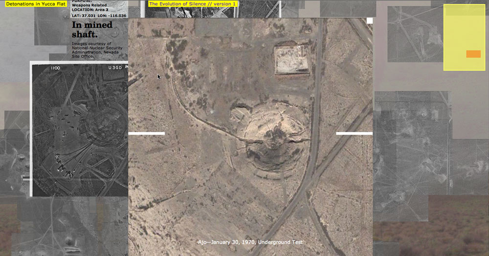
In an earlier post I described how difficult it was to narrow down my list of requested images to a recommended 5–7 images. The Foundation has generously awarded me six of those seven. Here are the images they gave me, roughly tiled together to show Yucca Flat valley. I can now make use of higher quality imagery (better than my web capture views) that provide much more detail of the landscape.
(Images courtesy of the GeoEye Foundation.)

About the GeoEye Foundation:
“The GeoEye Foundation is a not-for-profit philanthropic organization headquartered in Herndon, Virginia, focused on fostering the growth of the next generation of geospatial technology professionals. The Foundation provides satellite imagery to students, educational institutions and non-governmental organizations to advance research in numerous fields including human rights, defense and intelligence, public safety, healthcare, critical infrastructure, energy, environmental change and archeology. The Foundation believes that through observation comes awareness, and from awareness comes action.
The Vision of the GeoEye Foundation is to foster the growth of the next generation of users who apply geospatial technology in diverse and innovative ways to meet local, national and global challenges, and help improve the lives of individuals around the world.” (GeoEye Foundation)
If you would like to read more about other recipients of this kind of grant, click here.
If you are interested in how geospatial technology and mapping is used by the government and industry, and have also always wondered how satellite imagery is created, check out GeoEye’s video gallery.
(Video still from an animation at GeoEye.com.)

 The Evolution of Silence version 1—www.evolution-of-silence.net