Tour of the Nevada Test Site.

IMG1
With about twenty-five other visitors, I rode out to the Nevada Test Site on Thursday, December 13. (The Nevada Test Site now goes by the name: Nevada National Security Site.) Our full-day tour was led by Ernie Williams, a former Atomic Energy Commission employee and, at the age of 82, a participant and witness to most U.S. nuclear testing activity.

No pictures, no recording, no cellphones, no video allowed. While we drove around I noted the cable lines strewn about, the few subsidence craters I could see out the window, towers and other testing equipment that stands in ruin, the houses from the 1950s that, situated furthest from ground zero, remain as empty shells, and other evidence of experiments conducted.

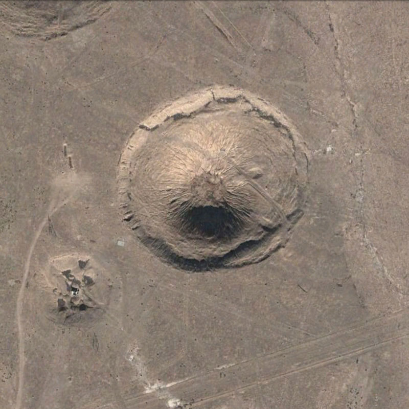
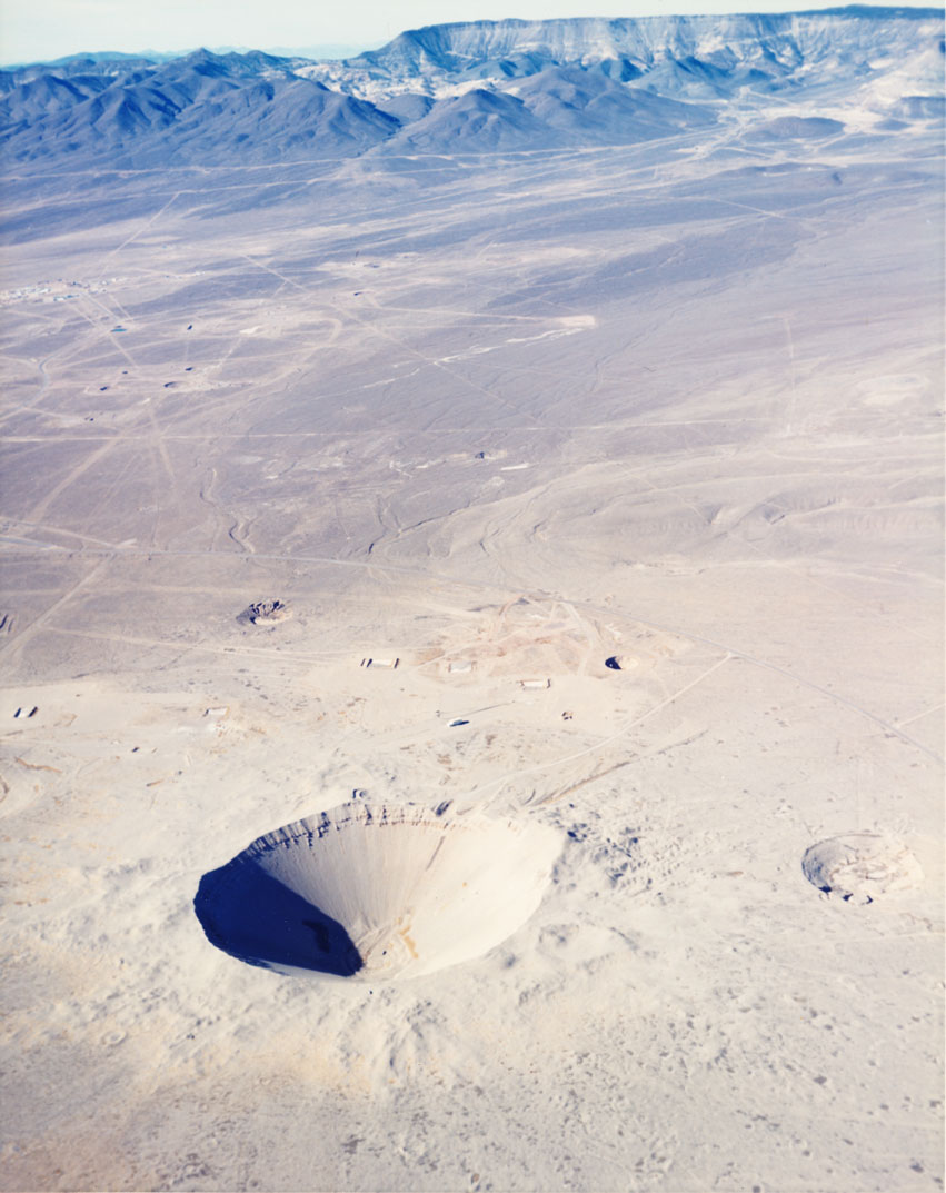
We were allowed off the bus at two spots within the site: in Frenchman Flat to stand underneath a warped steel bridge (damaged by the force of an early atmospheric nuclear test), and, later that afternoon in northern Yucca Flat, where we stood at the dramatic edge to Sedan Crater. It was a rainy and snowy day with little visibility. I was a little sad to have missed the view of mountains that surround the valley. From my 2008 visit I remember the feeling of vastness in the valley, and the feeling like we were inside a place. While mountains encircle Yucca Flat and there is a natural feeling of enclosure, the fact that it is a highly restricted area probably contributes to that impression.

Sedan Crater
IMG11
(Images courtesy of the University of Nevada Las Vegas Special Collections, DOE Collection.)

A mapping of all underground detonations in Yucca Flat.

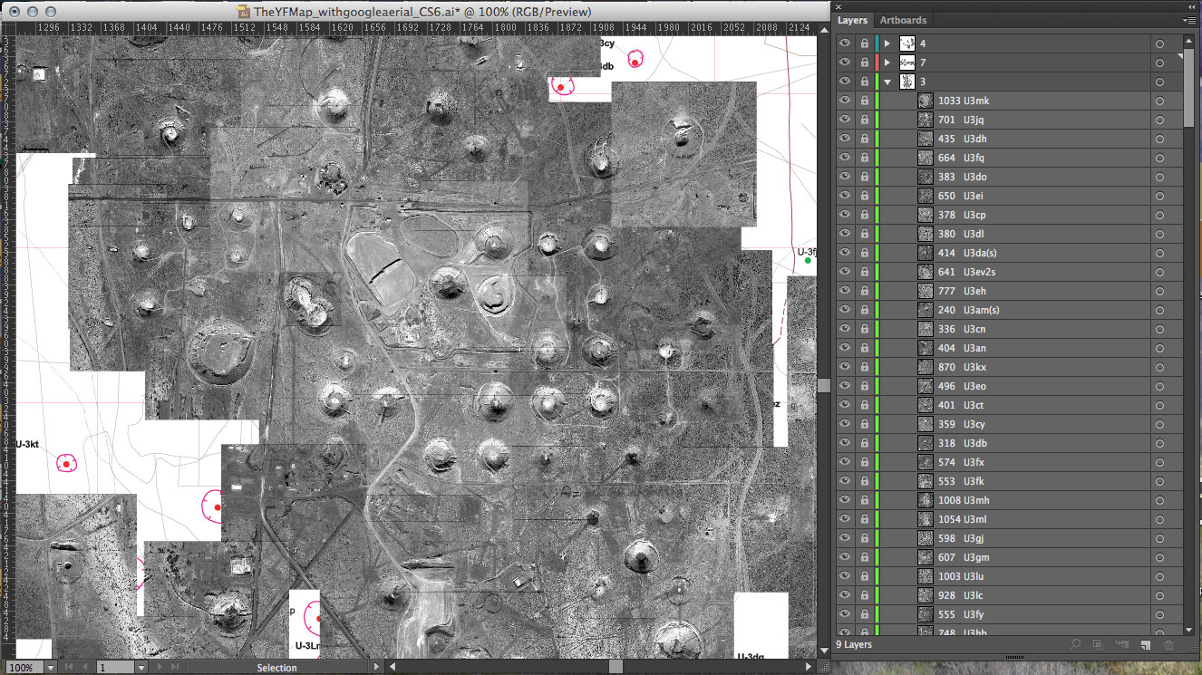
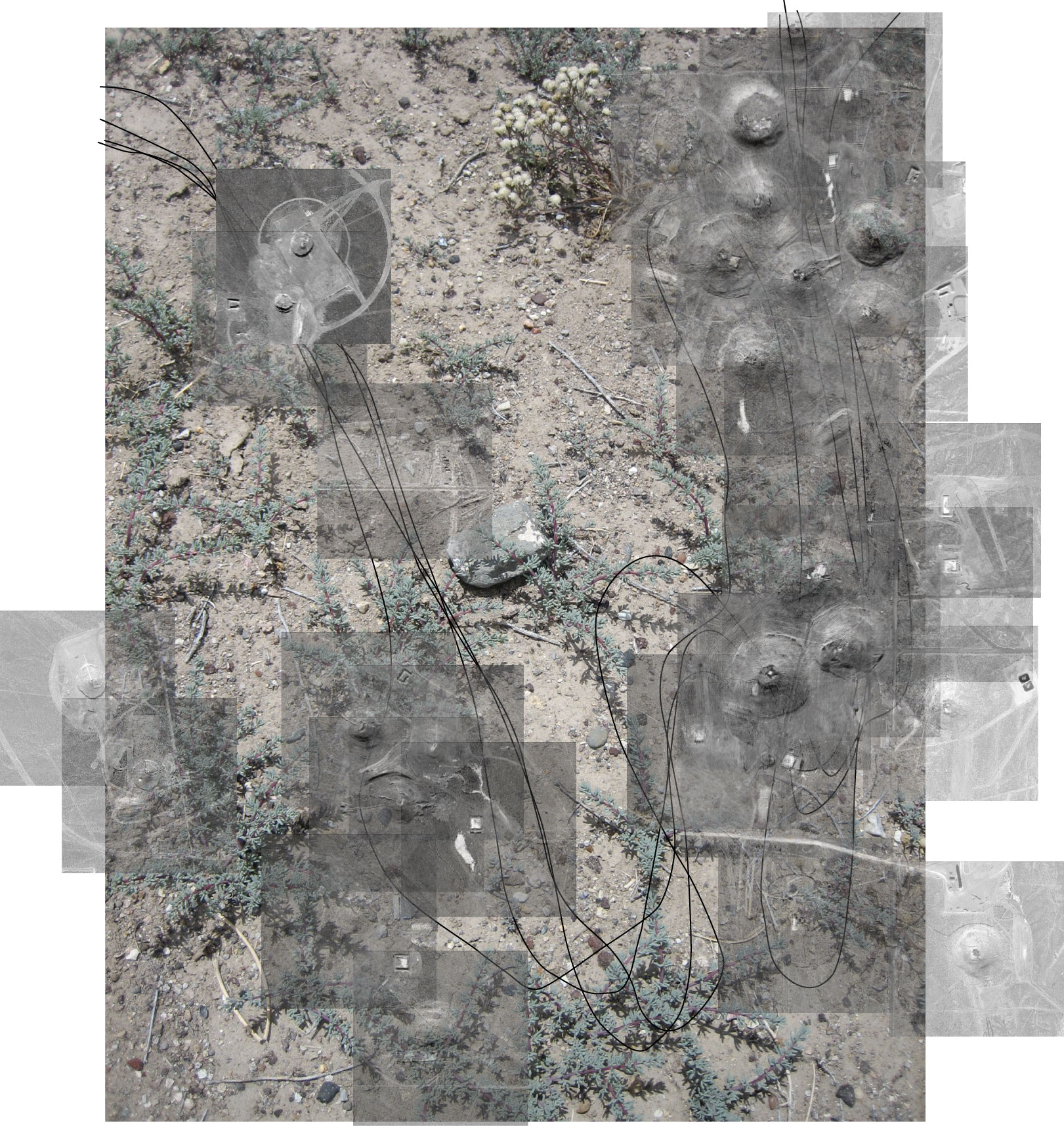
I finally finished mapping the sites of underground nuclear tests (still to map are the areas in which atmospheric testing took place). All underground nuclear explosions that took place in Yucca Flat are represented in this map. Individual images for each explosion at the exact site of their detonation are tiled together in (what became for me) a giant jigsaw puzzle, to form one aerial view of the valley.

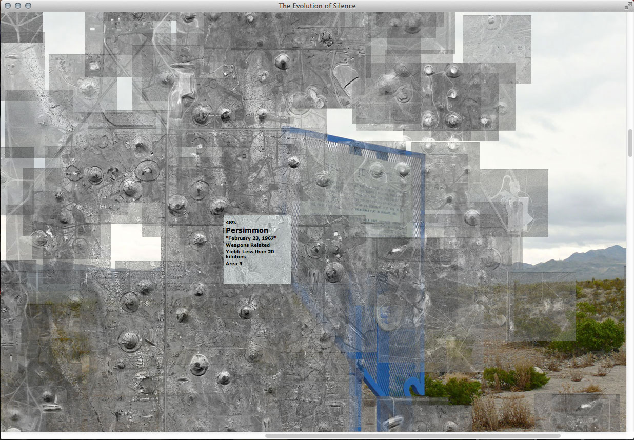
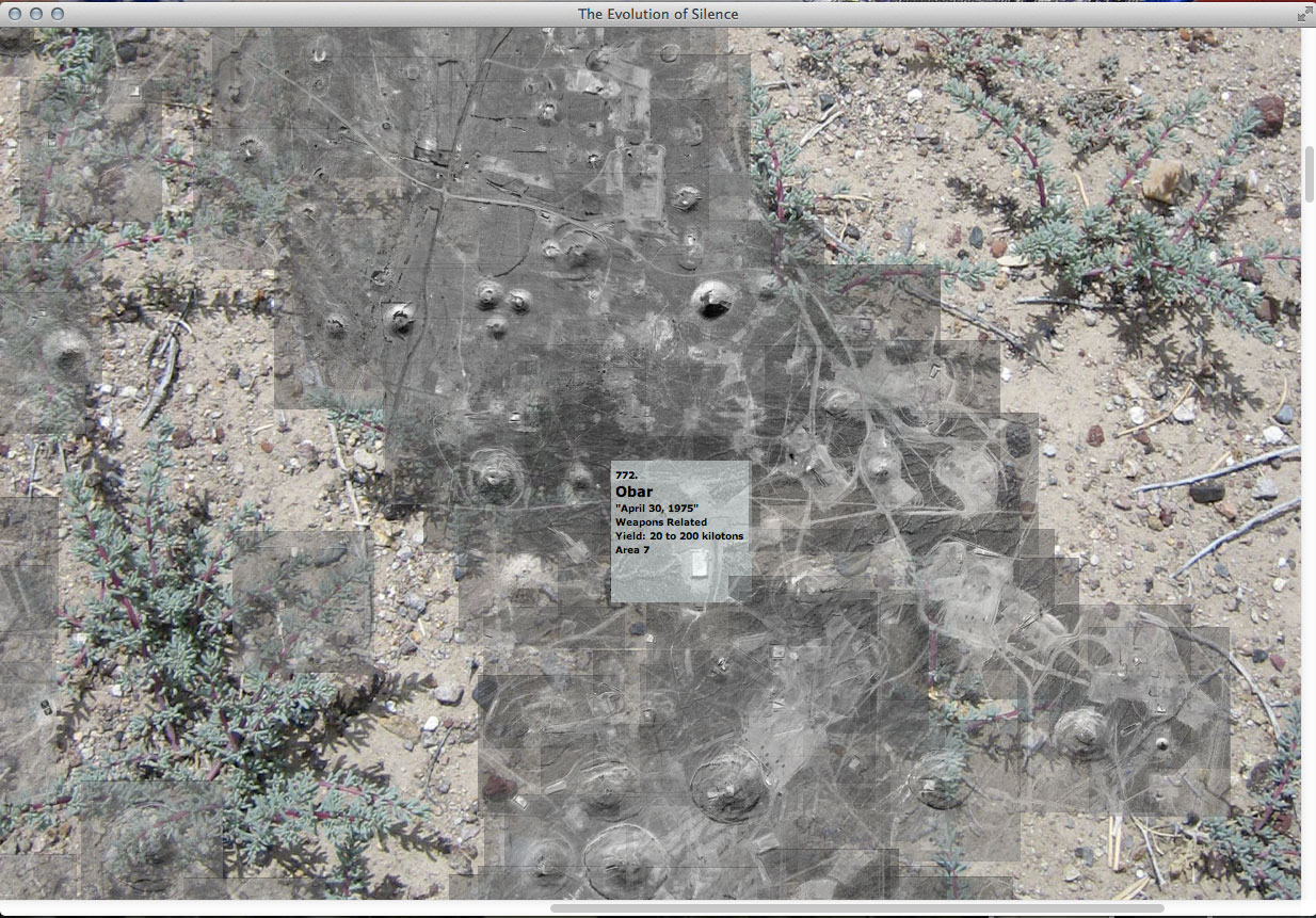
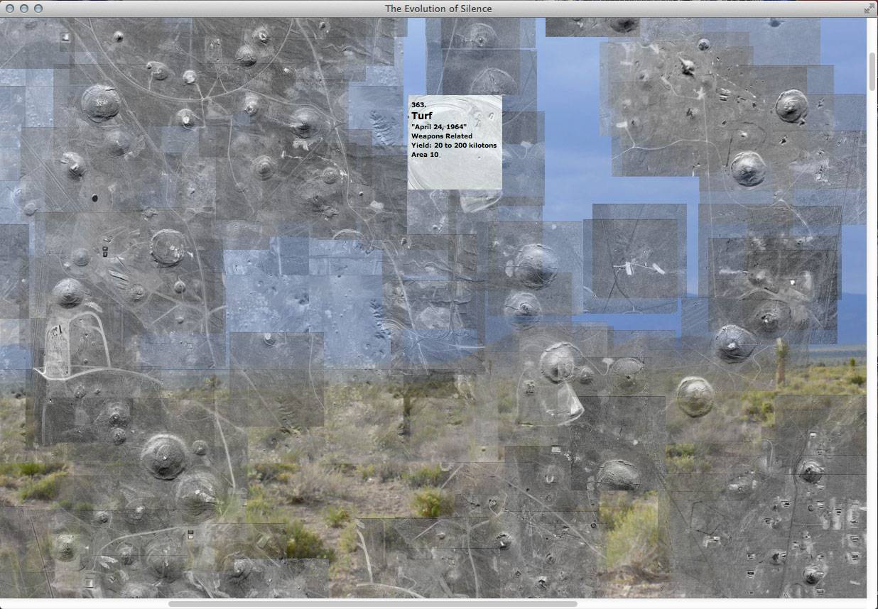
Now in geographic relationship to one another, the hundreds of small images come together to give a better sense of scale and convey the character of the valley. The web-based archive will interpret their ‘x’ and ‘y’ position coordinates (taken from my finished tiled map). The archive dynamically builds the map again in real time online. Below are screen shots of the archive running from my local file. It was worth the time it took do the map.

Mapping every detonation in Yucca Flat.

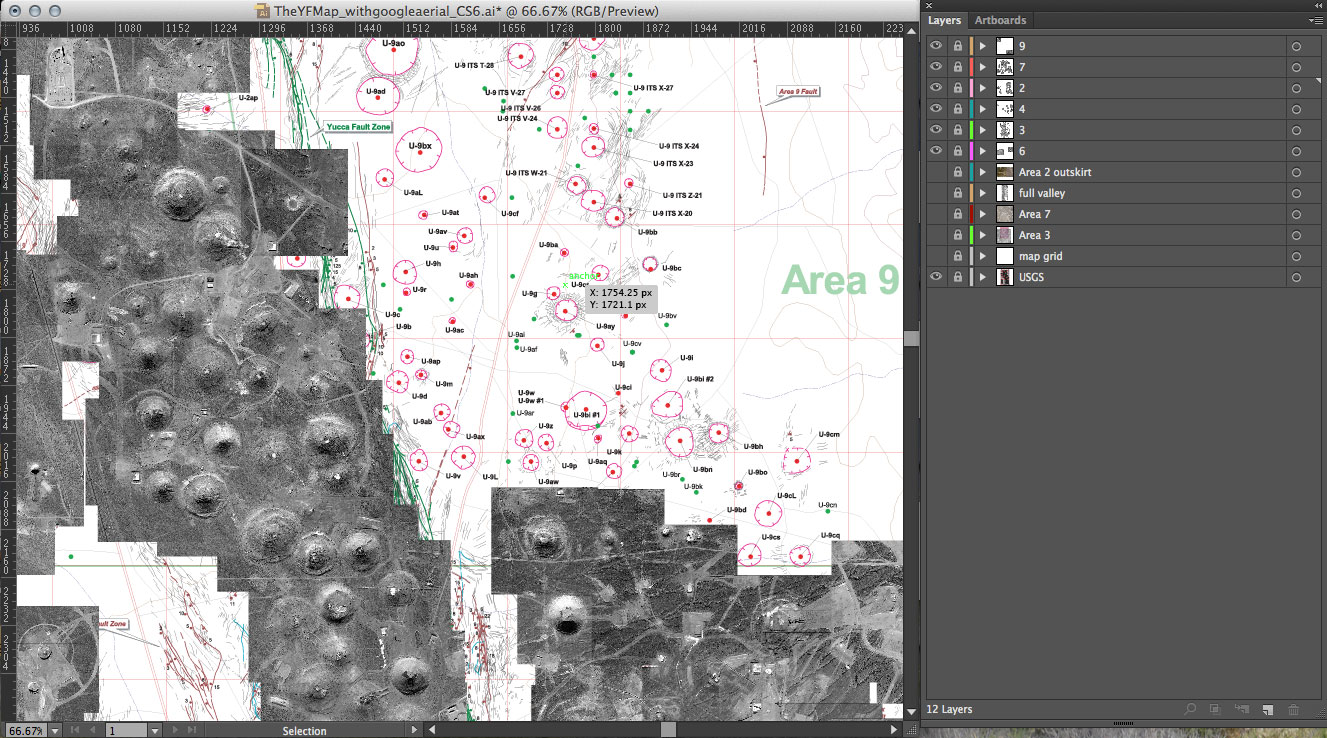
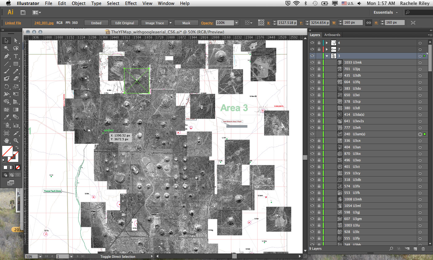
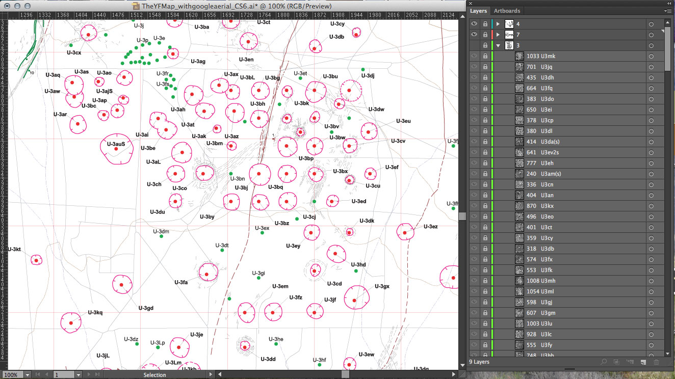
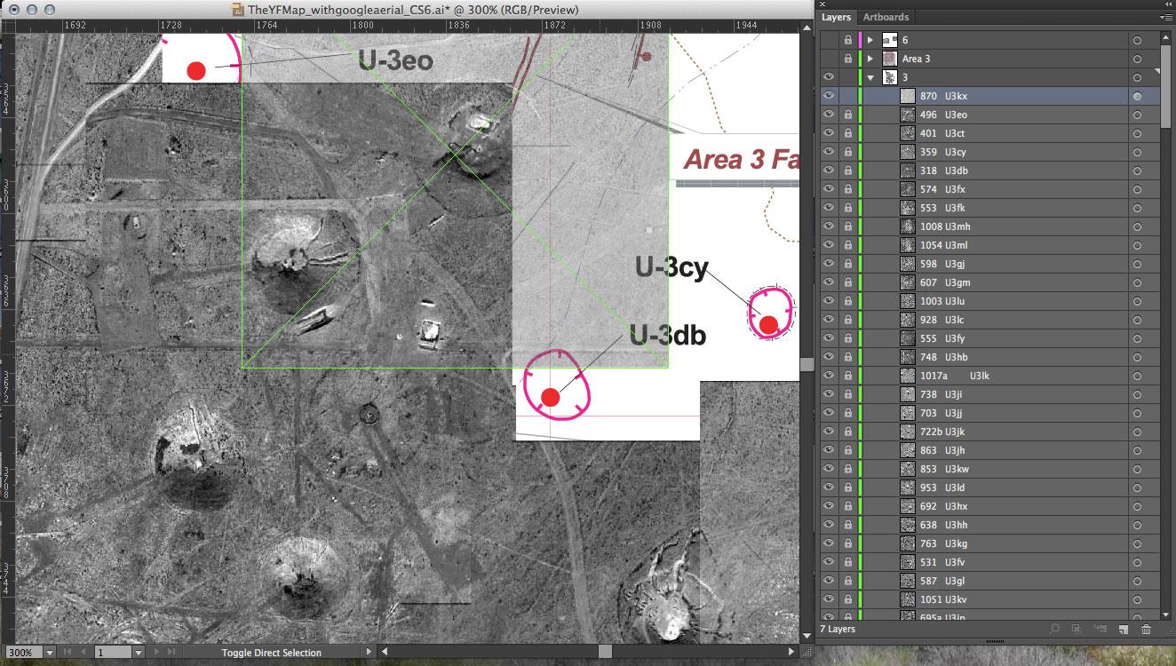
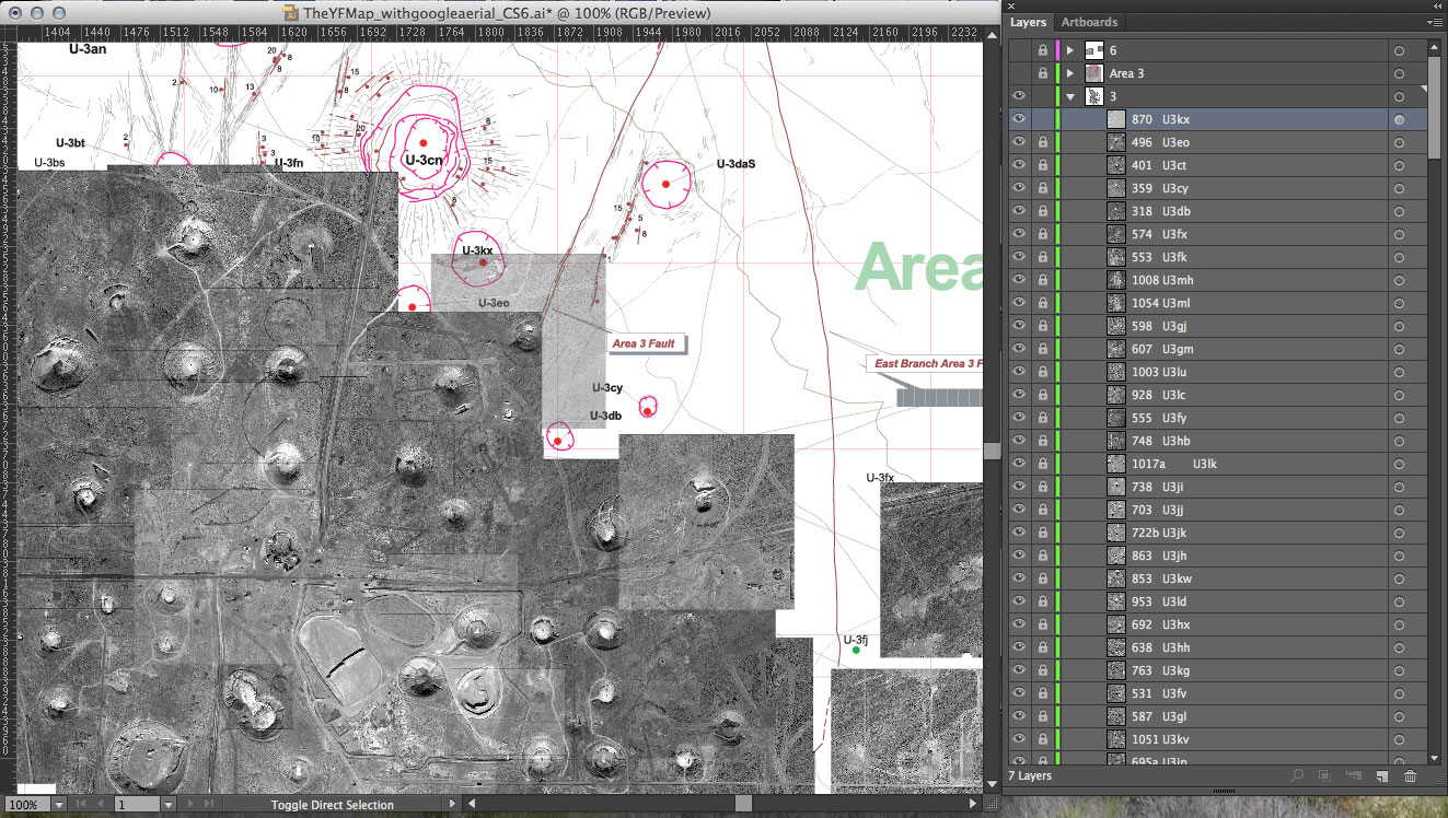
This week I focused on my map. I am tiling the individual images of each detonation to form one view of Yucca Flat valley. Using the USGS map as a guide in identifying the craters, I determine the relative (x,y) positions for each image. I enter that information into my dataset. The web-based archive is designed to pull dynamically from that data file. The map will build itself as it loads online and allow the viewer to interact with each detonation separately.

USGS map used (detail shown below): Dennis N. Grasso. “Geologic Surface Effects of Underground Nuclear Testing, Yucca Flat, Nevada Test Site, Nevada.” United States Geological Survey. 2000.

The full map in progress. Once I finish the straightforward aspect of this mapping, I can explore ways to include the one hundred detonations that occurred above ground in Yucca Flat. For these atmospheric tests, no bore holes or surface effects exist, and also no exact coordinates in the Department of Energy data.

Mapping for the web-based archive, the beginning.

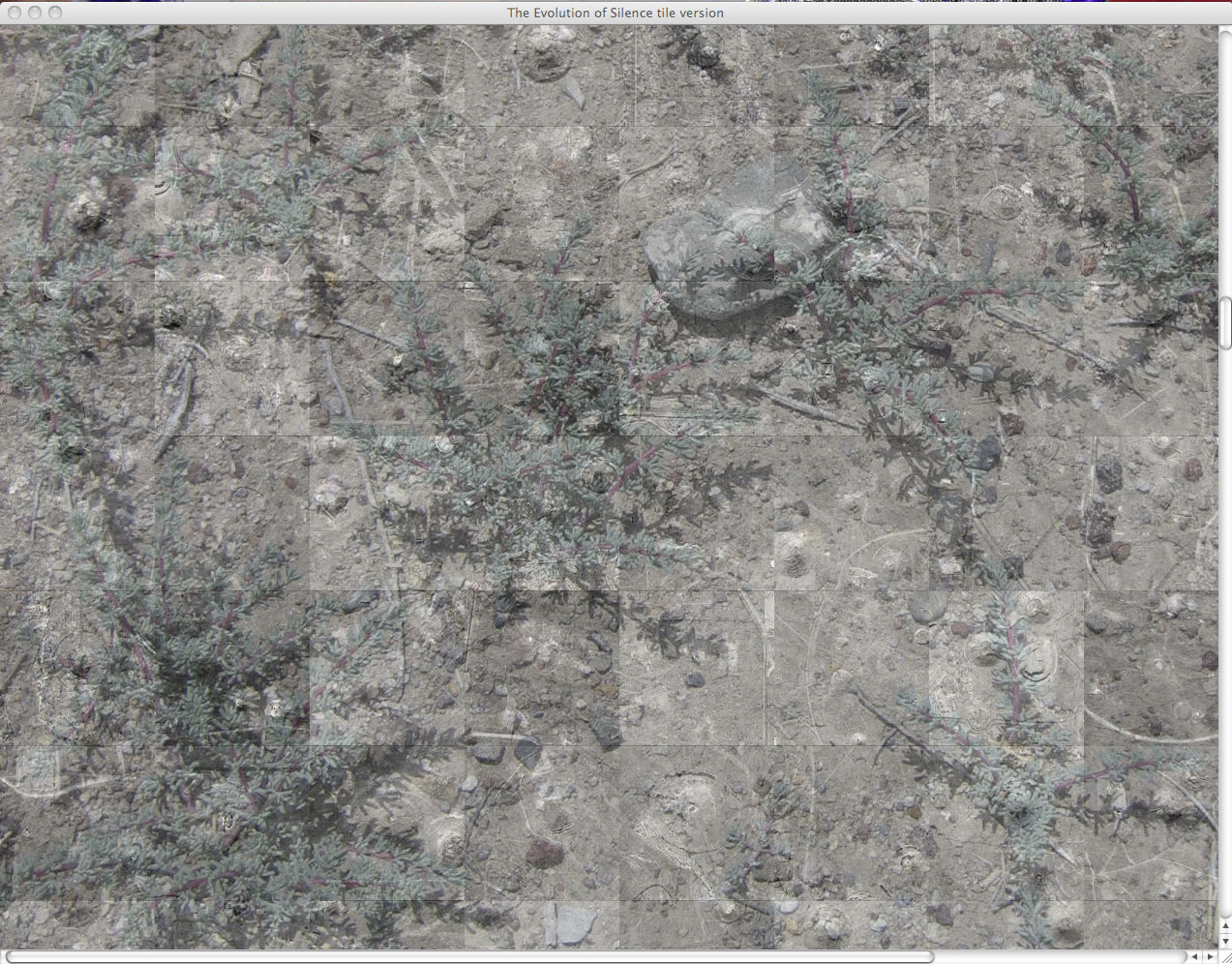
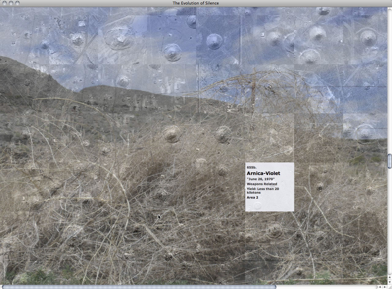
This is a screen shot of the web-based archive in which the detonations are organized initially by time (grid view). It presents the sites as fragments of a landscape.

I am working to create an alternate view which will present a relational view of the detonation sites. Below is a sketch from my storyboard.

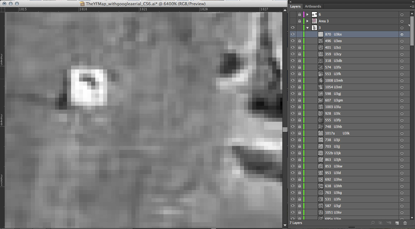
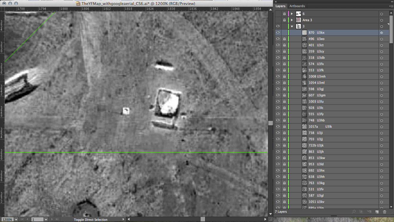
This is a screen shot from the mapping in progress. I am mapping my individual images to a USGS map of Yucca Flat.

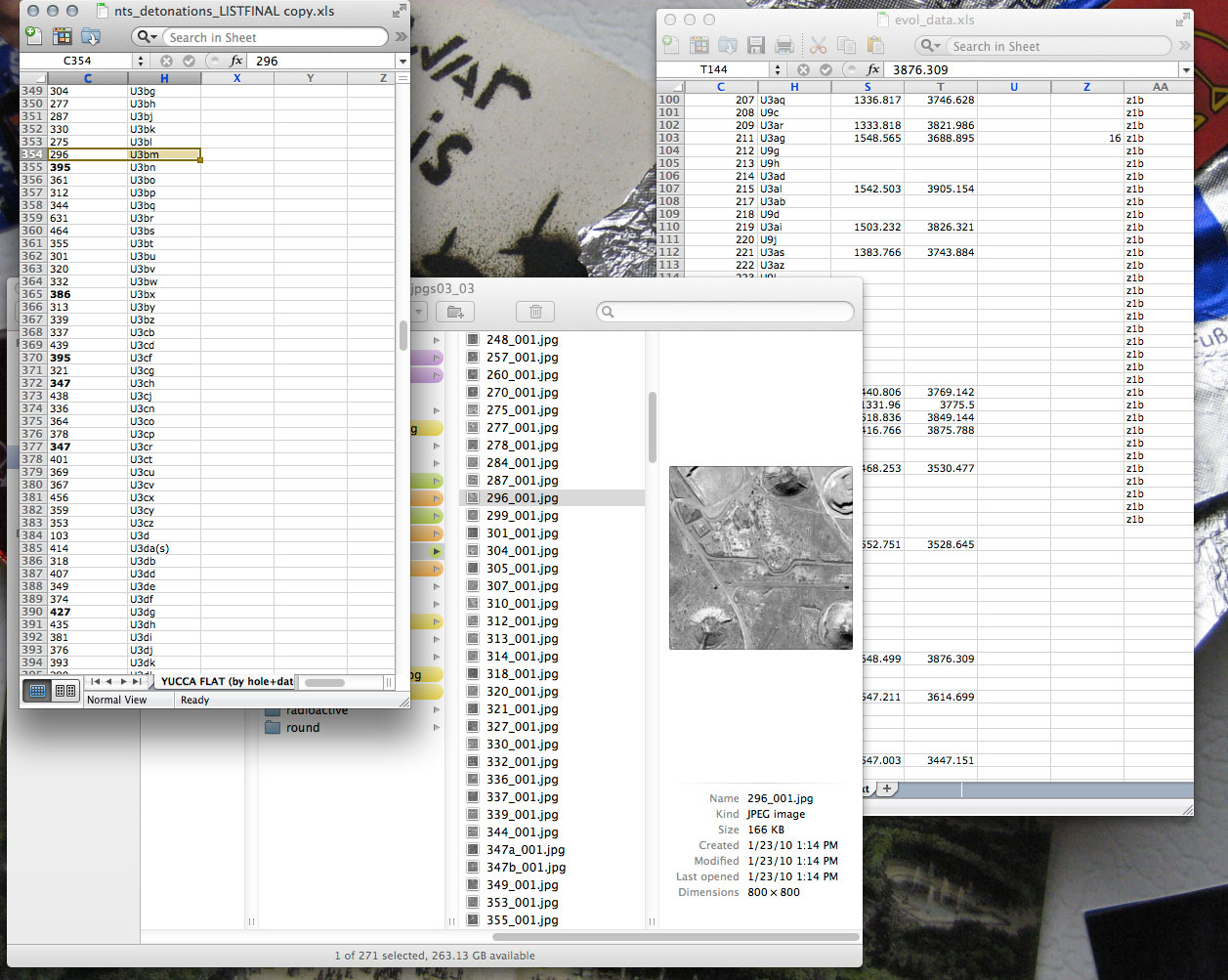
This is my data. All layers of information are in one excel sheet. The website pulls dynamically from this data file.

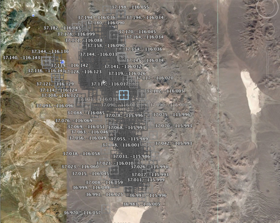
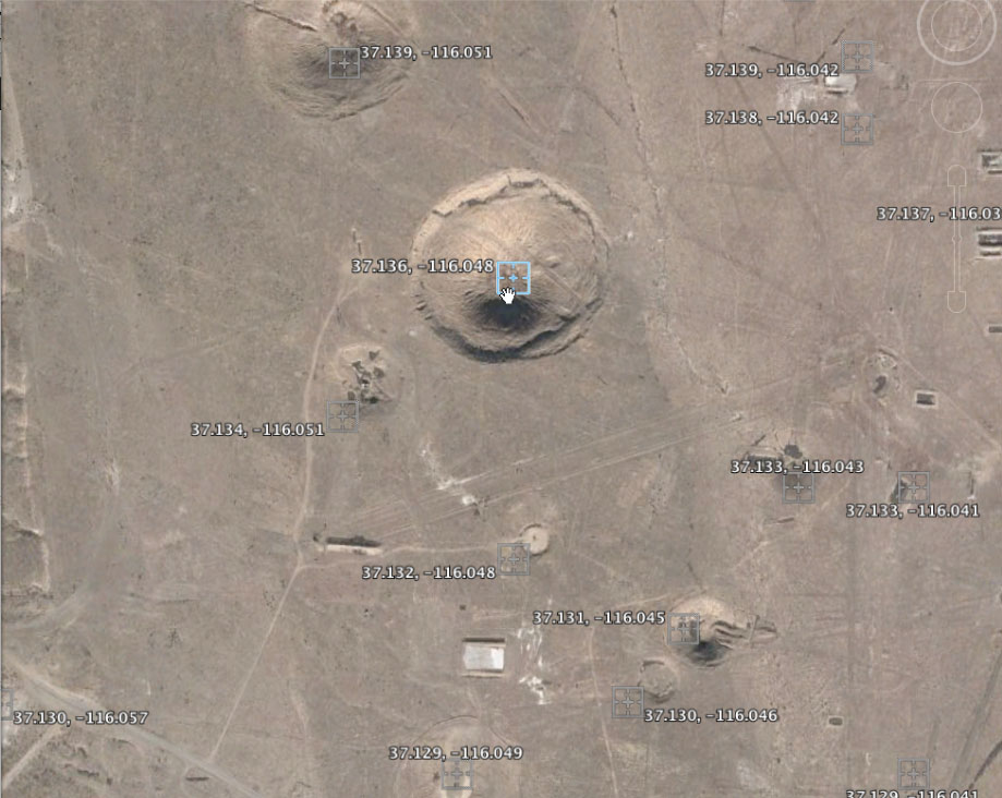
These next few images give you a sense of my process for collecting the individual photos of each detonation site from Google Earth. I plotted the coordinates for each explosion and captured screen shots at an elevation of 700 km.

I created this concept map for the archive to show the relationship of various layers and to use when discussing the design and development.

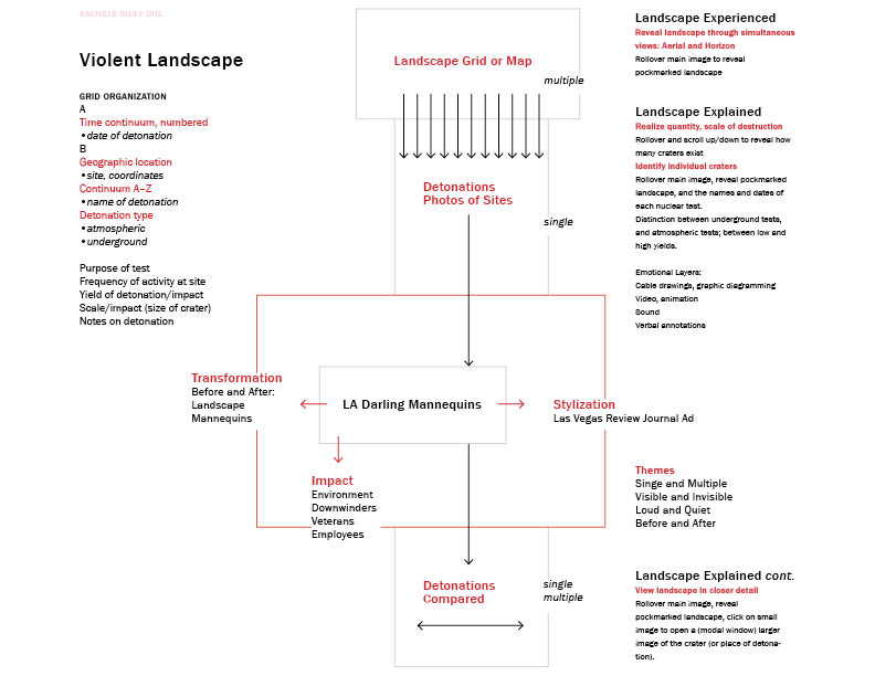
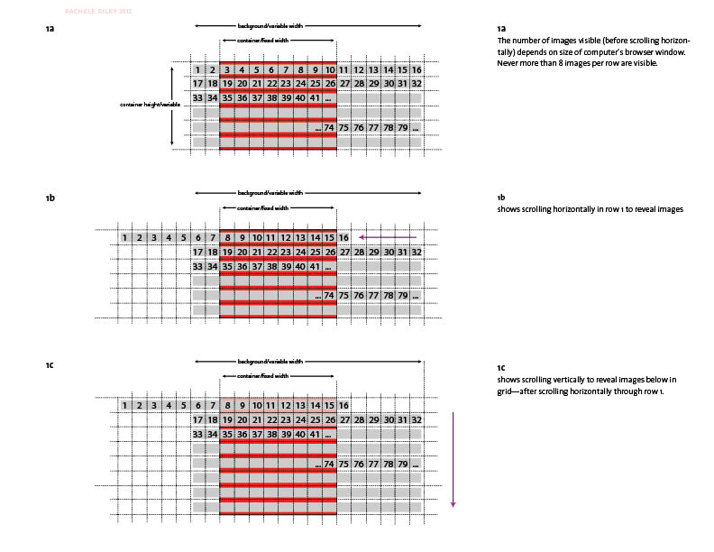
This diagram communicates the structure and movement of the archive organized by time (grid view). Used primarily in discussion with programmer, Danniel Gaidula.

An initial concept map for an early prototype, which, with Danniel Gaidula’s help, I have now completely re-coded.

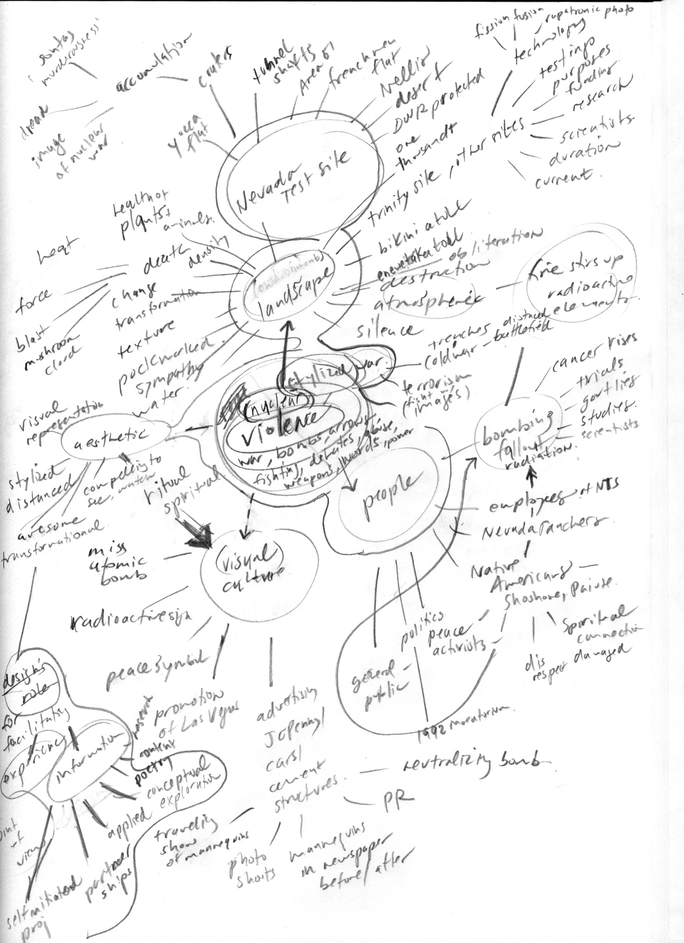
An early mind map for the project.

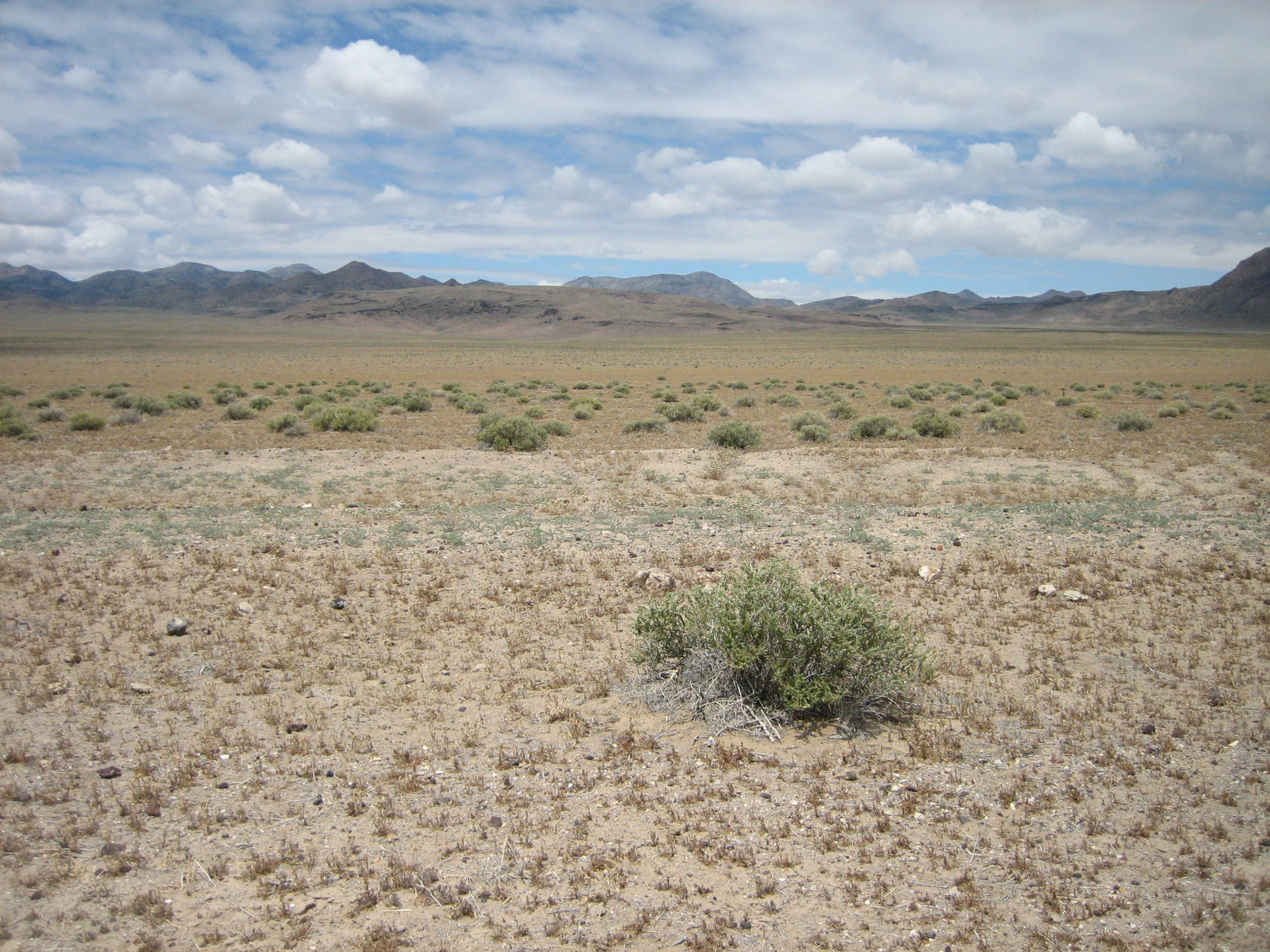
One of several photographs of the environment that I shot in May 2008 when I traveled to the site and around its periphery. These are used in the website to present a horizon view of the valley, in contrast to the aerial views.

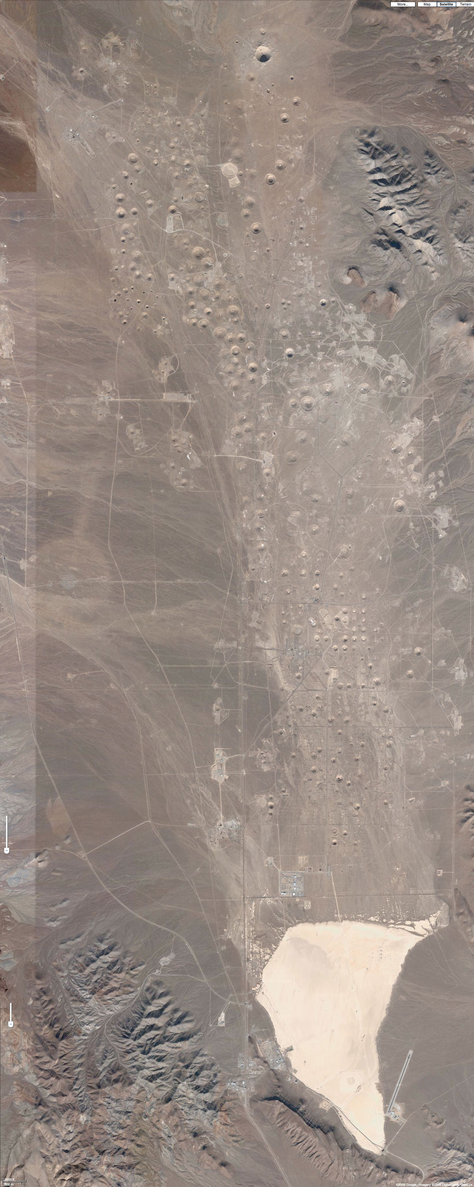
I tiled together hundreds of screen shots from Google Maps’ satellite view to form a complete aerial view of the valley. This was made after my trip in 2008.

I made a relief mapping of the craters. It is a test for collograph relief printing.

An Introduction to The Evolution of Silence.

An exploration of memory and destruction, ‘The Evolution of Silence’ is a multi-dimensional project that encompasses drawing, interactive design, mapping, printmaking, and installation. It is a creative investigation into the dramatic transformation of the Yucca Flat valley of the Nevada Test Site (Nevada National Security Site)—the site of experimental, post-World War II nuclear detonations.

I am creating a web-based archive, installation, and publication that present an exploration of a restricted landscape, and a visual mapping and interpretation of its destruction. ‘The Evolution of Silence’ allows one to bypass government boundaries and control of the area, making it possible for any individual to experience a cold war’s aftermath and silence.

The project gives form and expression to the data that I have gathered and organized, and is unique to other existing documentation of the Nevada Test Site in that it preserves an individual view of every nuclear detonation that occurred in Yucca Flat valley (828 nuclear explosions in total). The valley’s pockmarked surface of sink-hole craters is simultaneously beautiful and horrific. Considering the toll on the environment and the cost to human life, the valley is an important symbol of the impact of war.

I have been working on ‘The Evolution of Silence’ for a few years. The University of North Carolina at Charlotte funded my initial field research in 2008 (thank you), and since then, I have been working to design and develop an experience of a place of conflict for others. Thanks to The University of the Arts in Philadelphia, I have a sabbatical for the Fall 2012 semester and am going to be finishing Part 1 of the project: a web-based archive that presents multiple perspectives and experiences of the destruction. Part 2 will take place in 2013, as I prepare for the project’s extension and arrange for its public exhibition.