My presentation at the ‘Remaking Research’ symposium.

Screen Shot 2013-02-04 at 10.59.30 AM
The Emily Carr University of Art and Design has archived the ‘Remaking Research’ symposium online. Here is the link to video documentation of presentations made in ‘Featured Research Projects’ under the theme ‘The Political Economies of Research’ on Friday, November 2, 2012. My presentation is third.

More stills from my presentation. My map of Yucca Flat in detail:
Screen Shot 2013-02-04 at 11.08.29 AM

I love to talk about the research, the data I gathered, and the role my Excel sheet plays in the programming and design. I always show images of it.
Screen Shot 2013-02-04 at 11.02.52 AM

Drawing is often a way to get to know something, and it lives on in my web-based project:
Screen Shot 2013-02-04 at 11.00.37 AM

My vision for the Web: spatial, simultaneous, exploratory.
Screen Shot 2013-02-04 at 11.01.39 AM
Screen Shot 2013-02-04 at 11.15.11 AM
Screen Shot 2013-02-04 at 11.15.37 AM
Screen Shot 2013-02-04 at 11.16.04 AM

Here you can view the opening presentations to ‘Remaking Research.’

Proofing my map.

It’s especially moments like these when I wish I could afford to hire a studio assistant. After hours of mapping Yucca Flat last fall, I realized in proofing details in my code, that some of the coordinates for the map are wrong, and that the web is not translating parts of it correctly. It’s difficult to pinpoint where the mistakes are (with so many images tiled upon another), so I have no other option but to go through each detonation again. I will copy the ‘x’ and ‘y’ coordinates again for each: from my master map in Illustrator into my database in Excel (the file that drives the web map). This is a time-consuming task and, as a result, my other studio plans come to a halt. The map is one of the dominant visual features to the archive and it must be accurate. Starting today, let’s see how long this takes me.

My map in Illustrator (Area 2 and 10 in view):
Screen Shot 2013-01-30 at 9.44.10 PM

The web version where you can see some detonations are not tiling correctly:
Screen Shot 2013-01-30 at 6.16.09 PM

All Areas highlighted in Illustrator:
Screen Shot 2013-01-30 at 10.32.10 PM
Screen Shot 2013-01-30 at 10.58.47 PM

The database in Excel, with columns for x and y coordinates isolated:
Screen Shot 2013-02-03 at 10.08.28 AM

Back to web map:
Screen Shot 2013-02-02 at 5.05.15 PM

Update on the ‘Annie’ test mannequins.

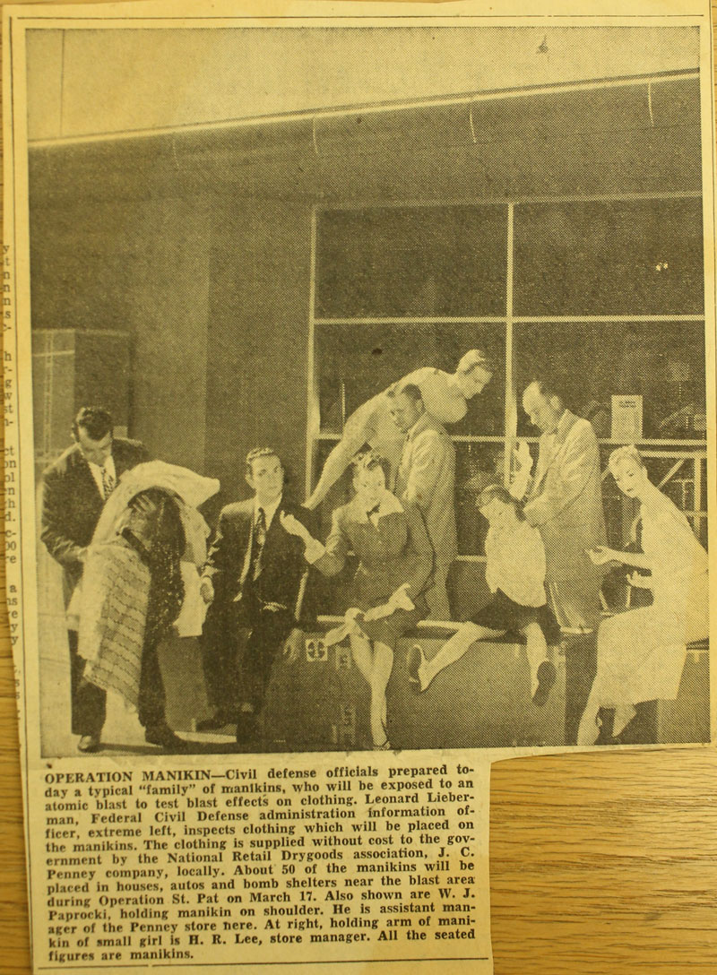
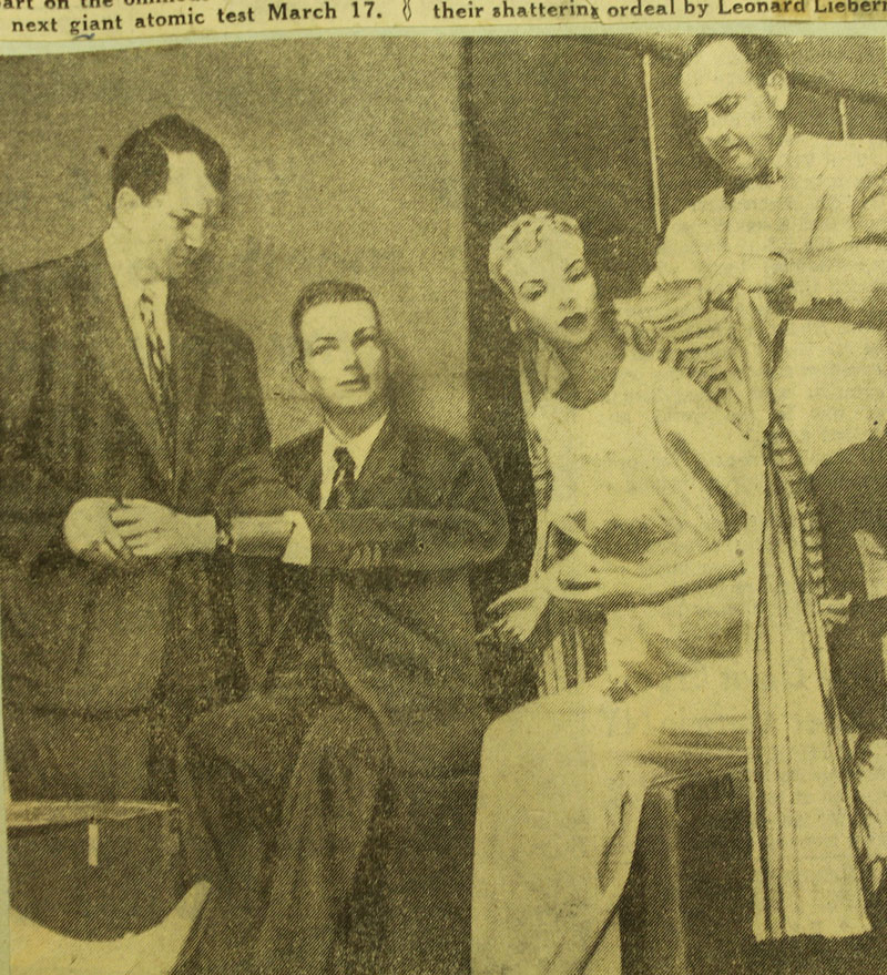
In Las Vegas I found photos of the mannequins being dressed and on display at the J.C. Penney store before the March 17, 1953 detonation.

Las Vegas Review Journal, March 6, 1953.
IMG_1748a

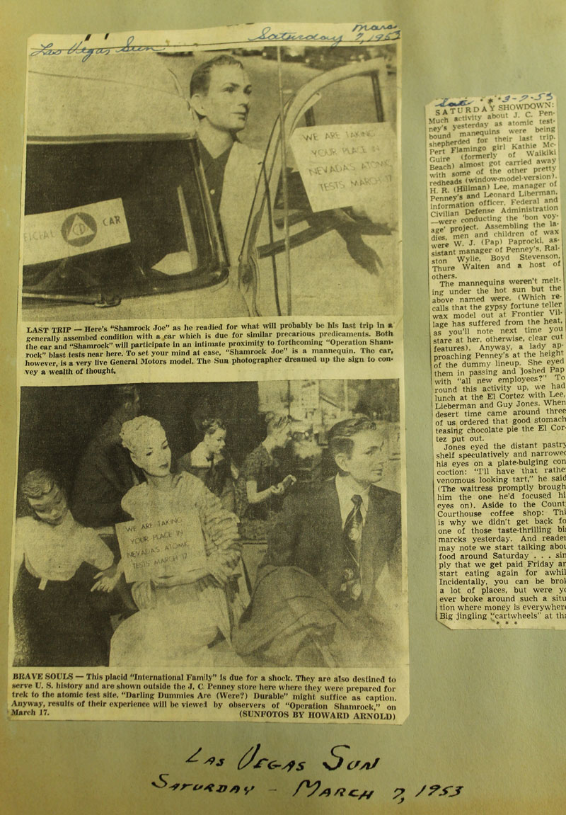
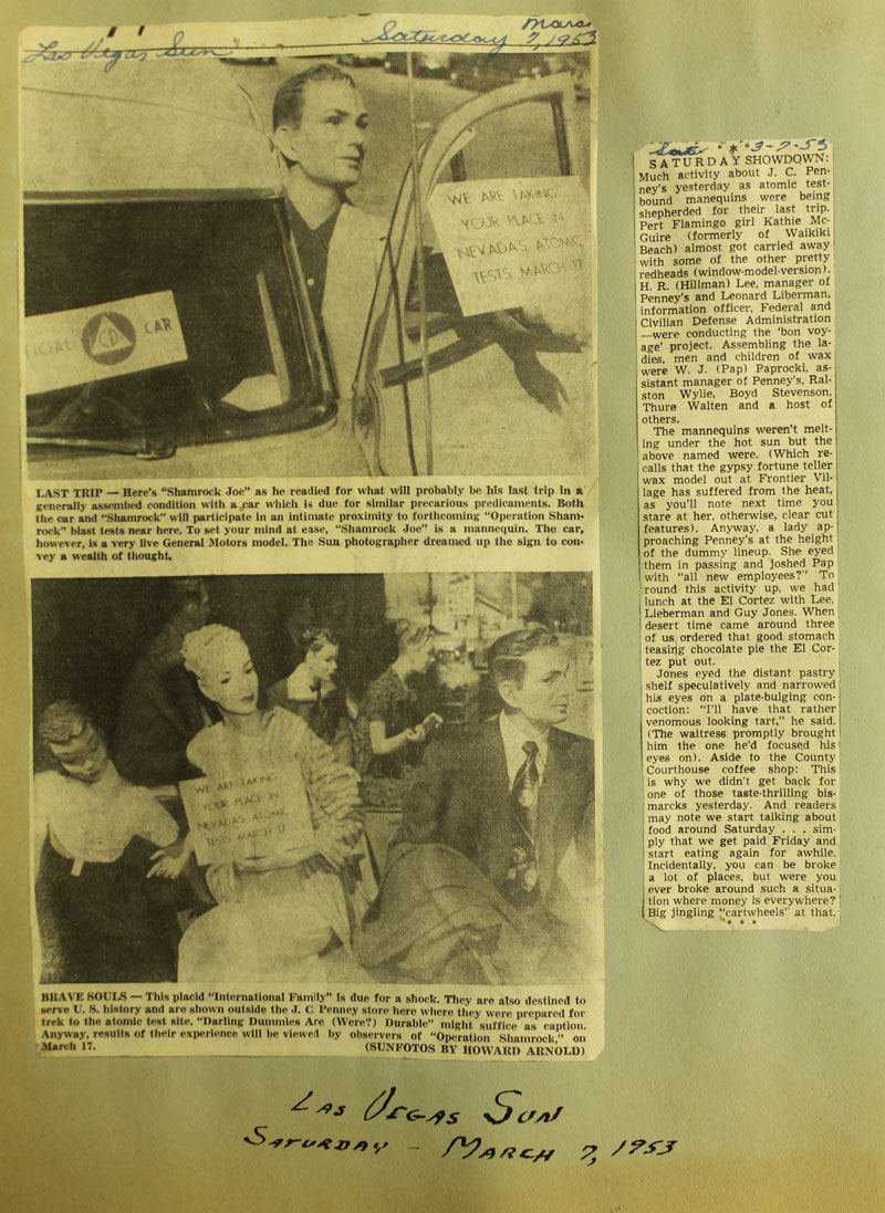
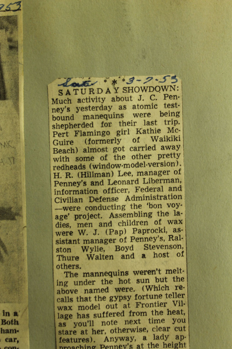
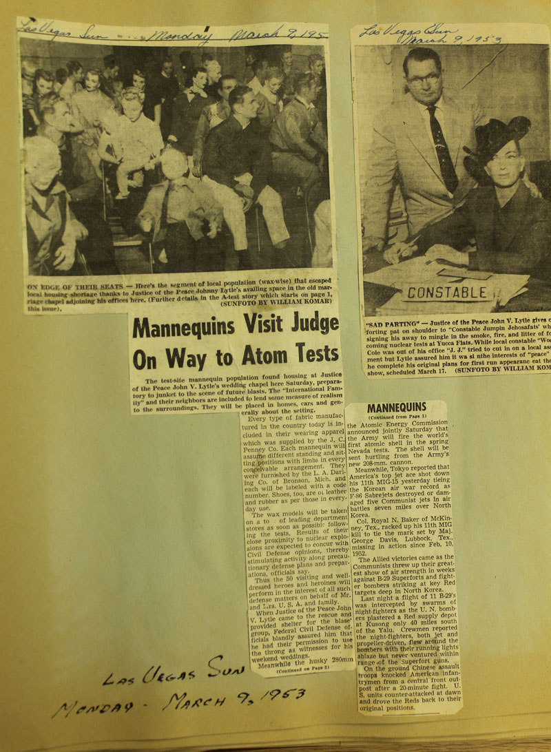
Las Vegas Sun, March 7, 1953.
IMG_1794a

Los Angeles Examiner, March 10, 1953
IMG_0539a

Las Vegas Review Journal, March 1953
0008

Las Vegas Review Journal, March 7, 1953
IMG_0489a

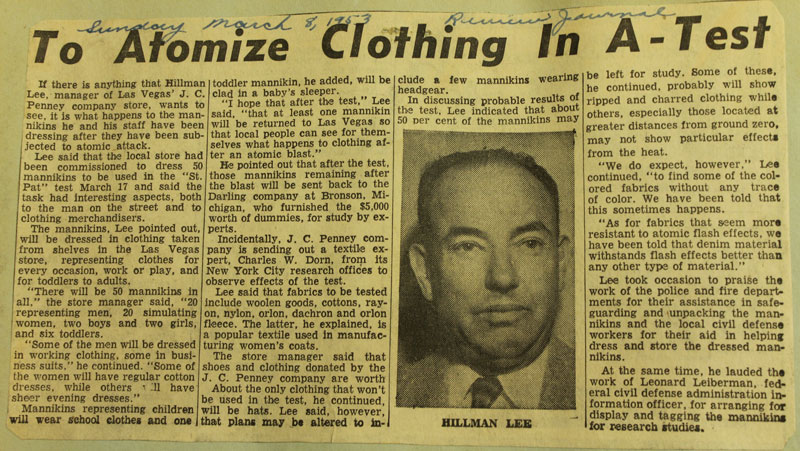
Las Vegas Review Journal, March 8, 1953
IMG_0513a

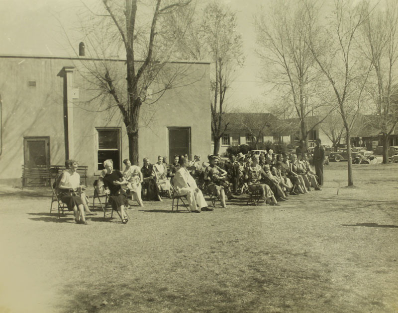
I found photos of the mannequins sitting in a group on chairs, being photographed outside in a Las Vegas neighborhood. I believe the photo was taken at Third and Carson Streets. James (Eure) could decipher ‘Third Street’ on the street sign in the first photo. Crystal (Van Dee) was able to confirm the street sign names as ‘Third and Carson’ with the help of a jeweler’s loupe.

IMG_1730a
IMG_1733a

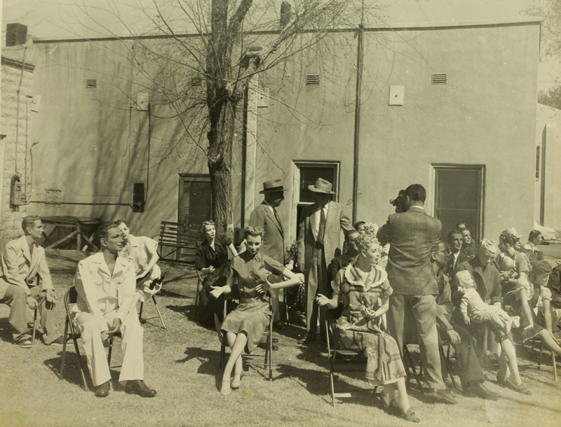
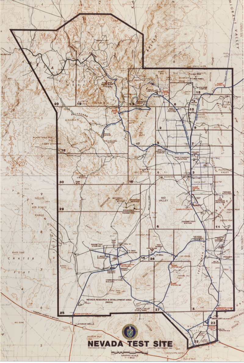
Searching further through the collections at the Nevada State Museum, I found a news release announcing that the County court house would be used in preparation for the March 17 test (at that time the court house stood at Third and Carson).
IMG_0452a
IMG_1736

Las Vegas Sun, March 9, 1953
IMG_1785a

The group photo outside is similar to one I found at the National Archives:
IMG_0743a

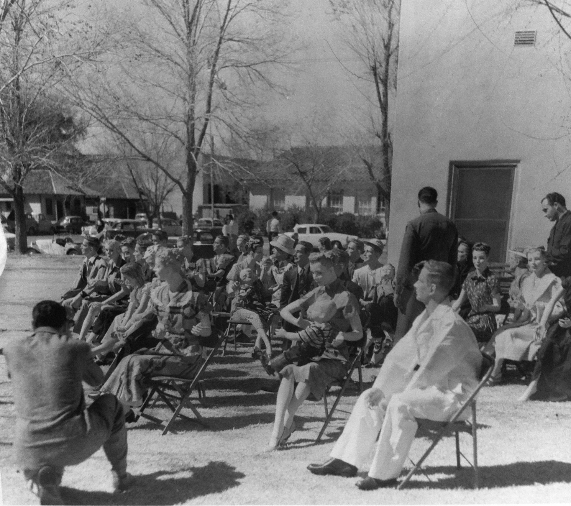
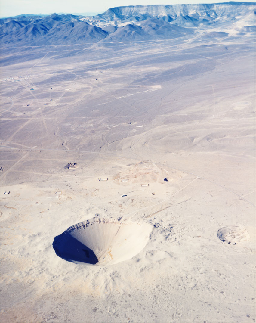
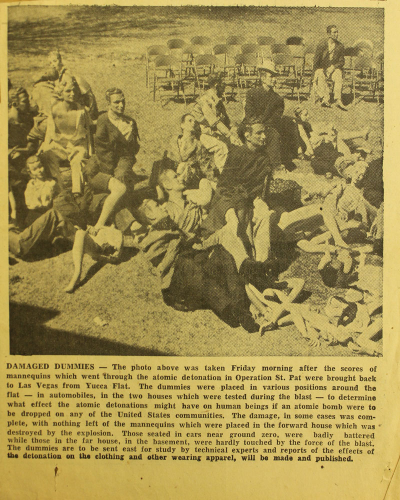
I found newspaper accounts that the mannequins had been removed from Yucca Flat and brought back to Las Vegas after the March 17, 1953 detonation. In this photo they are gathered again after the test, now damaged. They seem to be at the same site as in the earlier photo shoot (Third and Carson), but without a view of the houses across the street I can’t be certain.
IMG_1738a

It’s possible that this site (Third and Carson) is the setting of the J.C. Penney advertisement photo shoot. The double-page advertisement of ‘before’ and ‘after’ states of the mannequins was published in the Las Vegas Review Journal on April 3, 1953.
0005+6

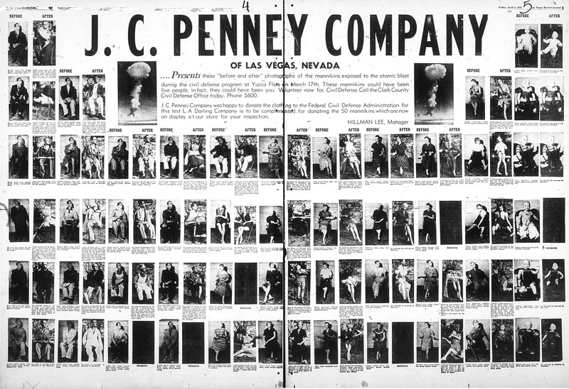
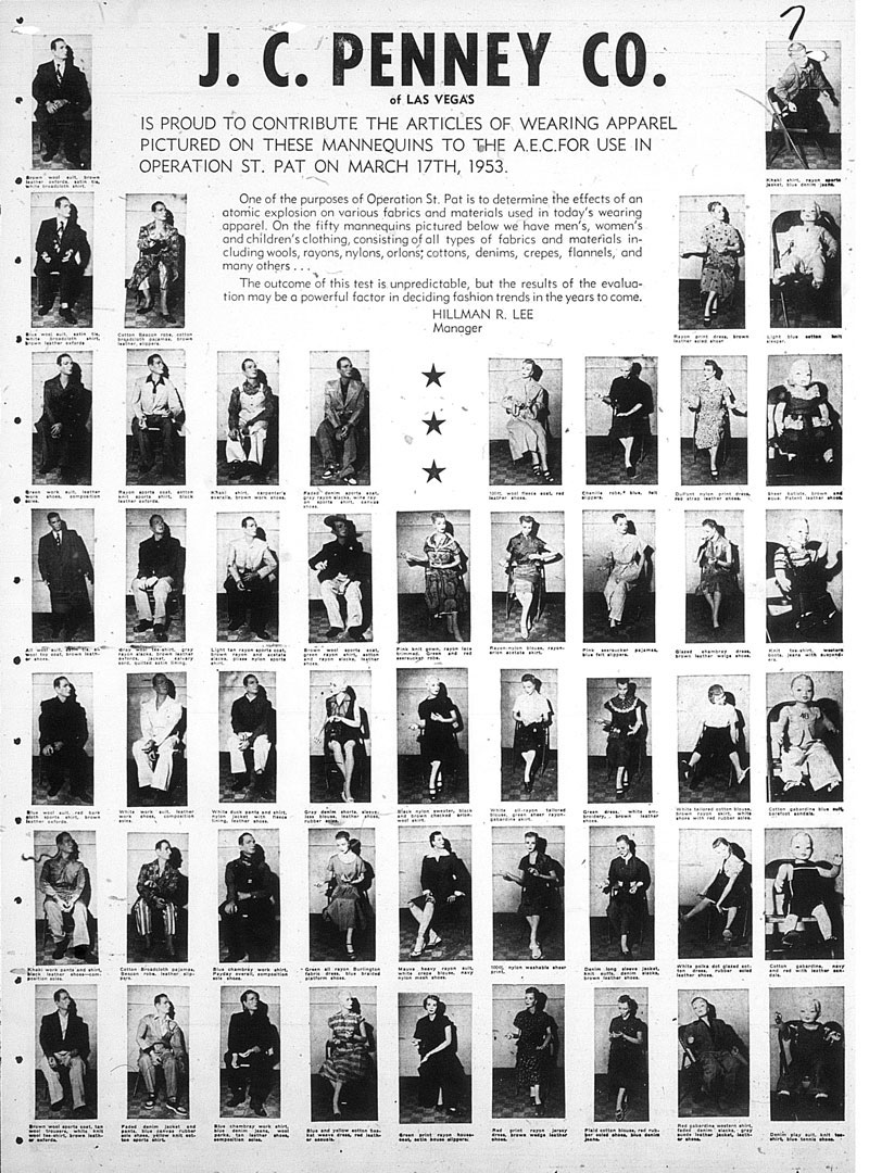
I found another J.C. Penney advertisement from early March 1953 featuring the mannequins in their ‘before’ state only in the Las Vegas Review Journal. These are the same ‘before’ shots used later in the April 3 comparison.
0003a

I did not find any pictures or accounts of the mannequins on public display at the J.C. Penney store after the detonation of March 17, 1953. For now, the question of the mannequins’ post-detonation display in Las Vegas (at J.C. Penney or elsewhere) remains unanswered.

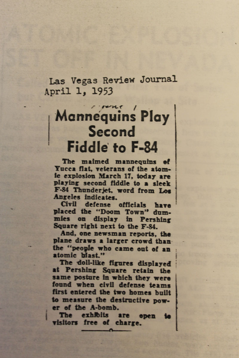
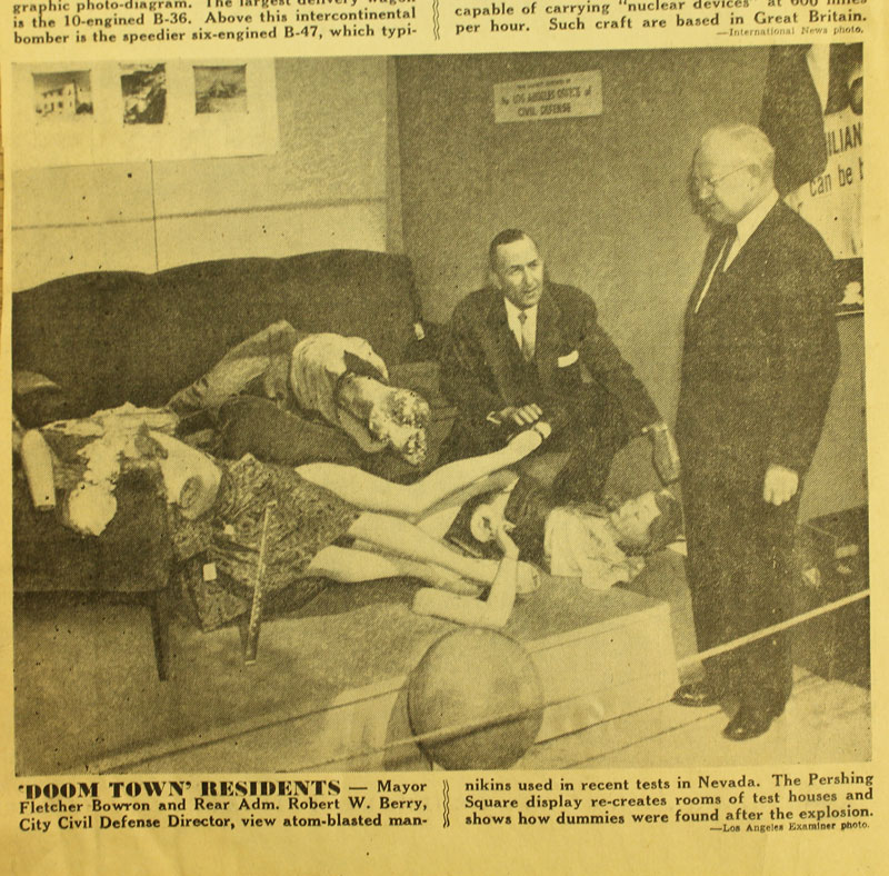
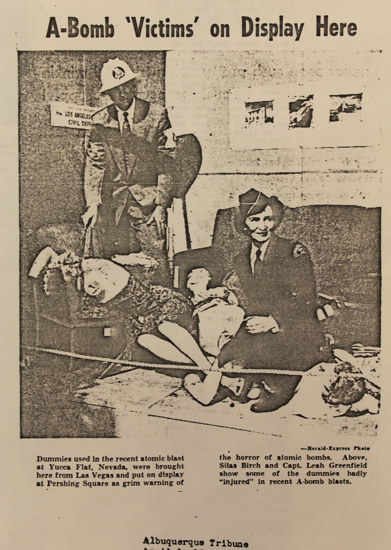
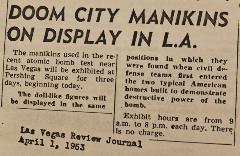
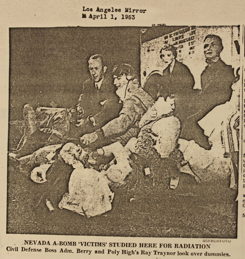
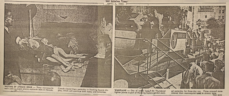
However, I did find several newspaper accounts of the mannequins on public display in Pershing Square in downtown Los Angeles in early April 1953. The mannequins were on view for three days and staged in similar ways to how they were found after the detonation at Yucca Flat. The newspapers report: ‘Mannequins play second fiddle to F-84’ (The F-84 Thunderjet was in an adjacent display). The mannequins were being studied for radiation in Los Angeles. I wonder whether the Civil Defense officials cancelled their plans for a nationwide tour of the mannequins after the exhibition in Los Angeles.

Los Angeles Examiner, April 1, 1953 Sec 1–3.
IMG_1756a

Albuquerque Tribune, April 1, 1953
IMG_2600

Las Vegas Review Journal, April 1, 1953
IMG_2596

Los Angeles Mirror, April 1, 1953
IMG_2592

Los Angeles Times, April 1, 1953.
IMG_2584+5

Las Vegas Review Journal, April 1, 1953.
IMG_2606

The subject of my archival research, appreciating Las Vegas.

There are three main threads to my archival research. I am searching for:
(1) any images or textual accounts of the L.A. Darling Co. Mannequins, information on their public display at the downtown J.C. Penney store in Las Vegas and the tour they allegedly made of other cities, confirmation that they were displayed both before and after the March 17, 1953 ‘Annie’ Test, and any leads to their current whereabouts;

(2) newspaper accounts of nuclear testing at Yucca Flat of the Nevada Test Site, any form of visual or textual documentation that provides a supplementary view to that of the Department of Energy, as well as images and films of atmospheric and underground testing activity, subsidence craters, cables, towers, vehicles, structures, and other ruins of testing experiments; and

(3) an analysis of the effects of nuclear testing on people, environment, politics and culture, documentation and records on (for example) the Baneberry venting case, protests at the NTS, and designed exhibits and publications.

Over the course of this project, I have searched the microfilm, manuscript, photo, film, map, book, and military collections of the Library of Congress, the Mercury Core Library and Data Center, the USGS Central Region Library, and the National Archives. This past December in Las Vegas, I spent several days in the archives and libraries of the Cahlan Research Library of the Nevada State Museum, the University of Nevada Las Vegas Special Collections, and the Nuclear Testing Archive. As a result of these hours spent, combing through personal collections, publications, ephemera, newspaper clippings, microfilm, photos, and film reels, I have hundreds of images and notes to add to my findings. This material will give further dimension to the project. In the next several weeks I will be working to interpret these discoveries and incorporate them into the archive and into my exhibition proposal.

I want to thank the people I met in Las Vegas who helped me with my research:
Crystal R. Van Dee, Curator of Manuscripts at the Cahlan Research Library
Karen Green, Curator at the National Atomic Testing Museum
Brian Paco Alvarez, Curator, Historian at the Las Vegas News Bureau Archive
Dan Garrison, Producer at Joshua Tree Productions Inc.
Jennifer Cornthwaite, Director of the Emergency Arts Center
Su Kim Chung, Manuscripts Librarian at UNLV Special Collections
Kelli Luchs, Photograph Archivist at UNLV Special Collections
Delores Brownlee, Library Technician at UNLV Special Collections
Thomas Sommer, University and Technical Services Archivist at UNLV Special Collections and
Dennis McBride, Director of the Nevada State Museum.
Thanks to James Eure for his assistance.

A page out of a scrapbook of clippings regarding Civil Defense, Patricia Lee Collection, Cahlan Research Library.
IMG_0493

Tour of the Nevada Test Site.

IMG1
With about twenty-five other visitors, I rode out to the Nevada Test Site on Thursday, December 13. (The Nevada Test Site now goes by the name: Nevada National Security Site.) Our full-day tour was led by Ernie Williams, a former Atomic Energy Commission employee and, at the age of 82, a participant and witness to most U.S. nuclear testing activity.

No pictures, no recording, no cellphones, no video allowed. While we drove around I noted the cable lines strewn about, the few subsidence craters I could see out the window, towers and other testing equipment that stands in ruin, the houses from the 1950s that, situated furthest from ground zero, remain as empty shells, and other evidence of experiments conducted.

We were allowed off the bus at two spots within the site: in Frenchman Flat to stand underneath a warped steel bridge (damaged by the force of an early atmospheric nuclear test), and, later that afternoon in northern Yucca Flat, where we stood at the dramatic edge to Sedan Crater. It was a rainy and snowy day with little visibility. I was a little sad to have missed the view of mountains that surround the valley. From my 2008 visit I remember the feeling of vastness in the valley, and the feeling like we were inside a place. While mountains encircle Yucca Flat and there is a natural feeling of enclosure, the fact that it is a highly restricted area probably contributes to that impression.

Sedan Crater
IMG11
(Images courtesy of the University of Nevada Las Vegas Special Collections, DOE Collection.)

Aerial photographs acquired from the USGS, the Freedom of Information Act.

In June 2011, I discovered that the United States Geological Survey (USGS) Mercury Core Library and Data Center in Henderson, NV stores ‘pre’ and ‘post’ detonation photographs of many nuclear tests conducted at the Nevada Test Site. I immediately inquired if I could have access to the photos of Yucca Flat for my project. After encountering resistance to my inquiry, I filed a Freedom of Information Act Request with the National Nuclear Security Administration (in March 2012), and I am happy to say that it is finally successful. I received all the images in the mail recently: several dozens of black-and-white aerial shots that were scanned and burned to nine discs for me. I want to thank all the people at the USGS and at the NNSA Office of Public Affairs who worked to fulfill my request.

Here are a few examples:
(Images courtesy of National Nuclear Security Administration, Nevada Site Office.)

Before:

After:

Before:

After:

A mapping of all underground detonations in Yucca Flat.

I finally finished mapping the sites of underground nuclear tests (still to map are the areas in which atmospheric testing took place). All underground nuclear explosions that took place in Yucca Flat are represented in this map. Individual images for each explosion at the exact site of their detonation are tiled together in (what became for me) a giant jigsaw puzzle, to form one aerial view of the valley.

Now in geographic relationship to one another, the hundreds of small images come together to give a better sense of scale and convey the character of the valley. The web-based archive will interpret their ‘x’ and ‘y’ position coordinates (taken from my finished tiled map). The archive dynamically builds the map again in real time online. Below are screen shots of the archive running from my local file. It was worth the time it took do the map.

Mapping every detonation in Yucca Flat.

This week I focused on my map. I am tiling the individual images of each detonation to form one view of Yucca Flat valley. Using the USGS map as a guide in identifying the craters, I determine the relative (x,y) positions for each image. I enter that information into my dataset. The web-based archive is designed to pull dynamically from that data file. The map will build itself as it loads online and allow the viewer to interact with each detonation separately.

USGS map used (detail shown below): Dennis N. Grasso. “Geologic Surface Effects of Underground Nuclear Testing, Yucca Flat, Nevada Test Site, Nevada.” United States Geological Survey. 2000.

The full map in progress. Once I finish the straightforward aspect of this mapping, I can explore ways to include the one hundred detonations that occurred above ground in Yucca Flat. For these atmospheric tests, no bore holes or surface effects exist, and also no exact coordinates in the Department of Energy data.

Identifying images for a GeoEye Foundation Imagery Grant.

I applied for a GeoEye Foundation Imagery Grant last month. The Foundation ‘provides satellite imagery grants to support research projects at the university level and within non-governmental organizations.’ (geoeye.com). The committee has expressed interest in my research and has asked me to revise my list of images. (I had requested more than they normally award.) I am able to submit a request for a maximum of seven images. It was much harder than I thought it would be to choose which images will work best for my project and for all the ways I hope to extend it. After narrowing down the original list to about eleven, I tiled the individual images to see which would best together. I am requesting the two sets below, a total of seven images.

I roughly tiled the images on my door ‘wall’ as well.

Several of the images I was considering, layered.